Papeles:AfricaCIA-HiRes.jpg

Kadakkel daytoy a panagipadas: 463 × 599 dagiti piksel. Sabali kadagiti resolusion: 185 × 240 dagiti piksel | 371 × 480 dagiti piksel | 593 × 768 dagiti piksel | 791 × 1,024 dagiti piksel | 1,632 × 2,112 dagiti piksel.
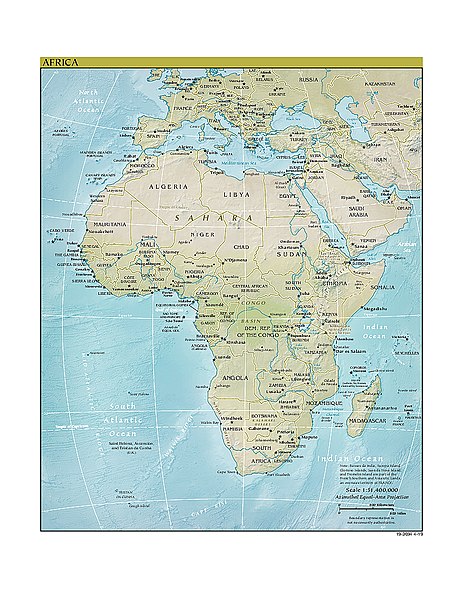
Kasisigud a papeles (1,632 × 2,112 dagiti piksel, kadakkel ti papeles: 2.01 MB, kita ti MIME: image/jpeg)
| Daytoy ket papeles a nagtaud manipud idiay Wikimedia Commons. Ti pakaammo manipud iti bukodna a deskripsion a panid idiay ket naiparang dita baba. Ti Commons ket repositorio dagiti nawaya a nalisensiaan a midia. Mabalinmo ti tumulong. |
This image is in the public domain because it contains materials that originally came from the United States Central Intelligence Agency's World Factbook.
|
 |
http://www2.cia.gov/africa.zip archive copy at the Wayback Machine
Derivate version
Derivative works of this file: Map of Africa hr.pdf
Pakasaritaan ti papeles
Pinduten iti petsa/oras tapno makita ti papeles a kas naiparang iti dayta a panawen.
| Petsa/Oras | Bassit a ladawan | Dagiti rukod | Agar-aramat | Komentario | |
|---|---|---|---|---|---|
| agdama | 03:45, 1 Hunio 2020 | | 1,632 × 2,112 (2.01 MB) | Bestoernesto | added the newest map with Eswatini |
| 18:39, 16 Hulio 2011 |  | 2,108 × 2,642 (854 KB) | Hoshie | added the newest map with South Sudan. Note this map has Kosovo and the colors have changed in recent years. | |
| 18:34, 11 Hunio 2005 |  | 1,218 × 1,500 (330 KB) | Dubaduba~commonswiki | {{PD-USGov-CIA-WF}} http://www2.cia.gov/africa.zip category:maps of Africa |
Panagusar iti papeles
Ti sumaganad a panid ket agus-usar iti daytoy a papeles:
Global a panagusar ti papeles
Dagiti sumaganad a wiki ket agus-usar iti daytoy a papeles:
- Panagusar idiay ace.wikipedia.org
- Panagusar idiay an.wikipedia.org
- Panagusar idiay as.wikipedia.org
- Panagusar idiay bs.wikipedia.org
- Panagusar idiay el.wikipedia.org
- Panagusar idiay en.wikipedia.org
- User:R4000/Africa(Alt)
- List of African cuisines
- User talk:Middayexpress/Archive 53
- Wikipedia:WikiProject Africa/The 10,000 Challenge
- Wikipedia:WikiProject Africa/The Africa Destubathon
- Wikipedia:WikiProject Africa/The Africa Destubathon/Fauna stubs - Africa
- Wikipedia:WikiProject Africa/The Africa Destubathon/Entries
- Template:The Africa Destubathon
- Wikipedia:WikiProject Africa/The Africa Destubathon/Prizes and bonuses
- Wikipedia:WikiProject Africa/The Africa Destubathon/Participants
- Wikipedia:WikiProject Africa/The Africa Destubathon/Leaderboard
- Wikipedia:WikiProject Africa/The Africa Destubathon/Entries for countries A to D
- Wikipedia:WikiProject Africa/The Africa Destubathon/Entries for countries E to K
- Wikipedia:WikiProject Africa/The Africa Destubathon/Entries for countries L to R
- Wikipedia:WikiProject Africa/The Africa Destubathon/Entries for countries S to T
- Wikipedia:WikiProject Africa/The Africa Destubathon/Entries for countries U to Z
- Wikipedia:WikiProject Africa/The Africa Destubathon/Entries for special claims
- User talk:Ms Sarah Welch/Archive 4
- Wikipedia:WikiProject Africa/The Africa Destubathon/Rules
- User:Kees08/sandbox1
- Panagusar idiay en.wikiquote.org
- Panagusar idiay fr.wikipedia.org
- Panagusar idiay hy.wikipedia.org
- Panagusar idiay hyw.wikipedia.org
- Panagusar idiay ie.wikipedia.org
- Panagusar idiay incubator.wikimedia.org
- Panagusar idiay it.wikipedia.org
- Panagusar idiay ja.wikipedia.org
- Panagusar idiay ki.wikipedia.org
- Panagusar idiay ko.wikipedia.org
- Panagusar idiay lij.wikipedia.org
- Panagusar idiay li.wikibooks.org
- Panagusar idiay ml.wikipedia.org
- Panagusar idiay mn.wikipedia.org
- Panagusar idiay or.wikipedia.org
- Panagusar idiay pl.wikipedia.org
Kitaen ti adu pay a global a panagusar iti daytoy a papeles.