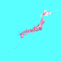
Papeles:Cities in Japan.png

Kadakkel daytoy a panagipadas: 600 × 600 dagiti piksel. Sabali kadagiti resolusion: 240 × 240 dagiti piksel | 480 × 480 dagiti piksel | 768 × 768 dagiti piksel | 1,024 × 1,024 dagiti piksel | 2,048 × 2,048 dagiti piksel | 5,310 × 5,310 dagiti piksel.
Kasisigud a papeles (5,310 × 5,310 dagiti piksel, kadakkel ti papeles: 883 KB, kita ti MIME: image/png)
Pakasaritaan ti papeles
Pinduten iti petsa/oras tapno makita ti papeles a kas naiparang iti dayta a panawen.
| Petsa/Oras | Bassit a ladawan | Dagiti rukod | Agar-aramat | Komentario | |
|---|---|---|---|---|---|
| agdama | 17:14, 1 Abril 2021 |  | 5,310 × 5,310 (883 KB) | そらみみ | update |
| 06:29, 2 Hunio 2020 |  | 5,310 × 5,310 (883 KB) | そらみみ | Update. | |
| 08:42, 18 Abril 2019 |  | 5,310 × 5,310 (883 KB) | そらみみ | Update. | |
| 18:53, 3 Oktubre 2018 |  | 5,310 × 5,310 (883 KB) | そらみみ | Updating. | |
| 06:09, 2 Abril 2018 |  | 5,310 × 5,310 (883 KB) | そらみみ | Updating. | |
| 11:04, 1 Enero 2017 |  | 5,310 × 5,310 (883 KB) | そらみみ | 八戸市 | |
| 16:20, 22 Disiembre 2016 |  | 5,310 × 5,310 (883 KB) | そらみみ | Adjusting. | |
| 19:01, 13 Disiembre 2016 |  | 5,310 × 5,310 (883 KB) | そらみみ | Adjusting color. | |
| 18:40, 13 Disiembre 2016 |  | 5,310 × 5,310 (883 KB) | そらみみ | Correcting and updating. | |
| 21:13, 18 Agosto 2015 |  | 5,310 × 5,310 (362 KB) | ASDFGH | {{Information |Description=Map of all Japanese cities including disputed territories |Source= File:Japan Municipality Map.png |Date= 2015-06-15 |Author= ASDFGH |Permission={{GFDL}} {{Convert to SVG}} |other_versions= }} [[Category... |
Panagusar iti papeles
Ti sumaganad a panid ket agus-usar iti daytoy a papeles:
Global a panagusar ti papeles
Dagiti sumaganad a wiki ket agus-usar iti daytoy a papeles:
- Panagusar idiay ar.wikipedia.org
- Panagusar idiay en.wikipedia.org
- Panagusar idiay fi.wikipedia.org
- Panagusar idiay hy.wikipedia.org
- Panagusar idiay id.wikipedia.org
- Panagusar idiay it.wikipedia.org
- Panagusar idiay ja.wikipedia.org
- Panagusar idiay ko.wikipedia.org
- Panagusar idiay ms.wikipedia.org
- Panagusar idiay ru.wikipedia.org
- Panagusar idiay si.wikipedia.org
- Panagusar idiay th.wikipedia.org
- Panagusar idiay tl.wikipedia.org
- Panagusar idiay tr.wikipedia.org
- Panagusar idiay uz.wikipedia.org
- Panagusar idiay zh.wikipedia.org


