Papeles:Indonesia - Location Map (2013) - IDN - UNOCHA.svg

Kasisigud a papeles (SVG a papeles, babassit ngem 250 × 250 pixels, kadakkel ti papeles: 1.06 MB)
| Daytoy ket papeles a nagtaud manipud idiay Wikimedia Commons. Ti pakaammo manipud iti bukodna a deskripsion a panid idiay ket naiparang dita baba. Ti Commons ket repositorio dagiti nawaya a nalisensiaan a midia. Mabalinmo ti tumulong. |
Pakabuklan
| Deskripsion |
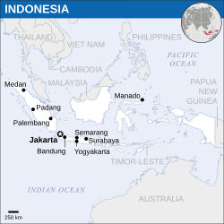
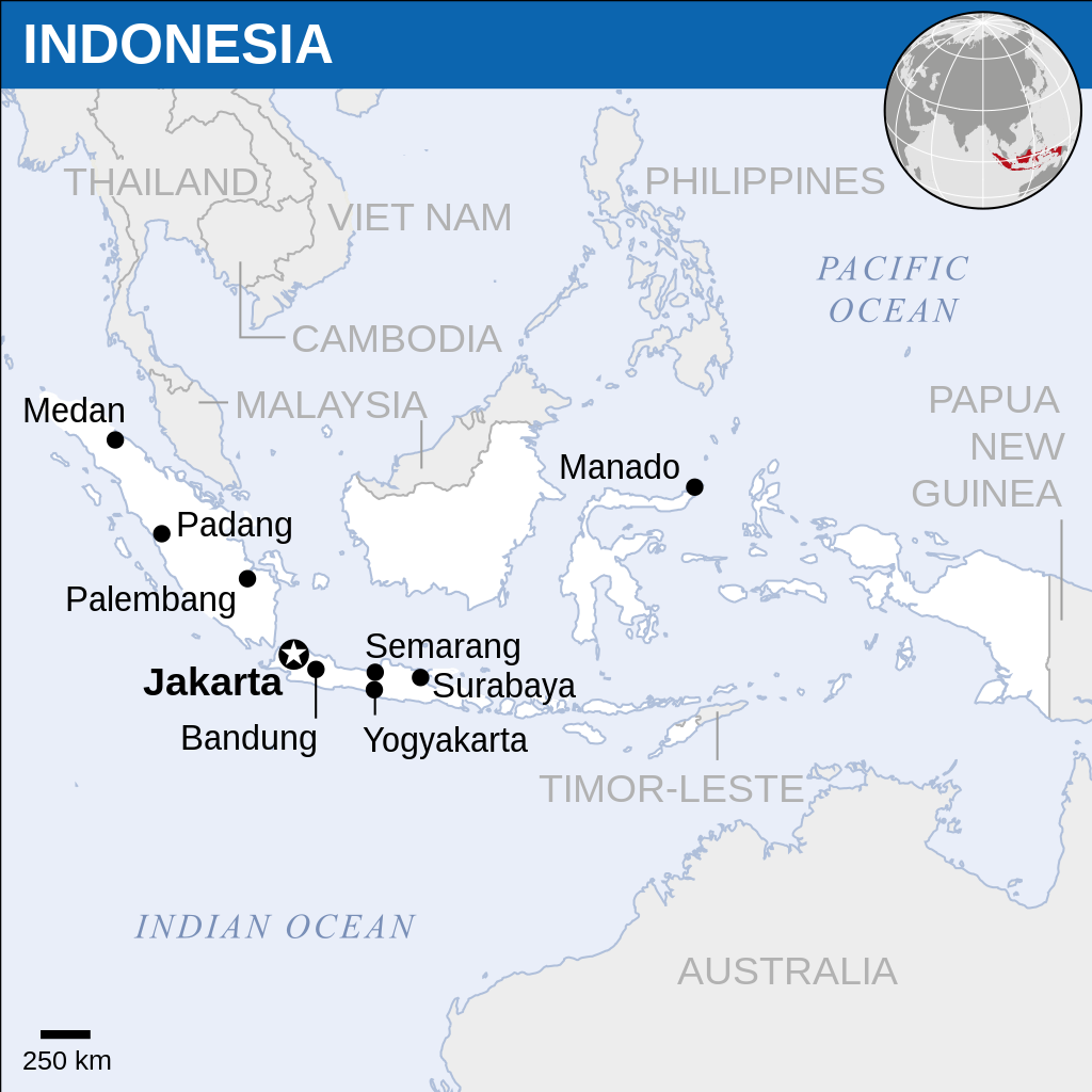
English: Locator map of Indonesia. |
| Petsa | |
| Taudan |
English: Indonesia Locator Map (ReliefWeb), ESRI, UNCS |
| Mannurat | |
| Dagiti sabali a bersion |
|
| SVG genesis |
_-_IDN_-_UNOCHA-id.svg)
_-_IDN_-_UNOCHA.svg)
Lisensia
- Nawaya ka:
- ti makibingay – ti ag-kopia, agiwaras ken agipatulod ti obra
- ti pagtipon-tipon – ti panagibagay ti obra
- Babaen kadagiti sumaganad a kasasaad:
- pammadayaw – Nasken a mangtedka iti pammadayaw, mangited iti silpo iti lisensia, ken mangibaga no adda dagiti nabaliwan. Mabalinmo nga aramiden iti ania man a pamay-an, ngem iti san a waya a mangisingasing a mangigupit kenka wenno iti panagusarmo.
 This map is part of a collection of 216 free country maps, created by the UN Office for the Coordination of Humanitarian Affairs (OCHA), to be used in print, web or broadcast products.
The ReliefWeb Location Maps released here are maps that highlight a country, its capital, major populated places and the surrounding regions. Attribution Requirements
Using the map without modifications: ensure that the sources and the disclaimer are below the map. Credit as follows: "Credit: OCHA". For use with alteration: remove the OCHA logo and disclaimer following any modification to the map, but keep the data sources as mentioned below the map. Credit the modified map as follows: "Based on OCHA map". You are responsible for the content of your map. We are keen to receive your feedback and hear how you used OCHA's maps. We would be grateful if you would notify us by e-mail and share your work with us. UN Disclaimer
The designations employed and the presentation of material of this map do not imply the expression of any opinion whatsoever on the part of the Secretariat of the United Nations concerning the legal status of any country, territory, city or area or of its authorities or concerning the delimitation of its frontiers or boundaries. |

|
Textual information (e.g. timestamp) once visible in the image itself has been moved into the image metadata and/or image description page. This makes the image easier to reuse and more language-neutral, and makes the text easier to process and search for. Commons discourages placing visible textual information in images. All licenses accepted on Commons permit this type of modification as a derivative work.
If attribution information were removed and the image is not public domain, replace this tag with {{Attribution metadata from licensed image}}.
|
Pakasaritaan ti papeles
Pinduten iti petsa/oras tapno makita ti papeles a kas naiparang iti dayta a panawen.
| Petsa/Oras | Bassit a ladawan | Dagiti rukod | Agar-aramat | Komentario | |
|---|---|---|---|---|---|
| agdama | 13:51, 9 Marso 2022 | | 250 × 250 (1.06 MB) | Nyilvoskt | File uploaded using svgtranslate tool (https://svgtranslate.toolforge.org/). Added translation for id. |
| 12:47, 19 Marso 2016 |  | 250 × 250 (1.06 MB) | Wereldburger758 | Resized page to drawing. Removal watermark. Validation of image. | |
| 03:11, 21 Abril 2014 |  | 254 × 254 (1.01 MB) | UN OCHA maps bot | == {{int:filedesc}} == {{Information |description={{en|1=Locator map of Indonesia.}} |date=2013 |source={{en|1=[http://reliefweb.int/map/indonesia/indonesia-location-map-2013 Indonesia Locator Map (ReliefWeb)]}} |author={{en|1=[[w:en... |
Panagusar iti papeles
Ti sumaganad a panid ket agus-usar iti daytoy a papeles:
Global a panagusar ti papeles
Dagiti sumaganad a wiki ket agus-usar iti daytoy a papeles:
- Panagusar idiay ban.wikipedia.org
- Panagusar idiay en.wikipedia.org
- Panagusar idiay incubator.wikimedia.org
- Panagusar idiay pl.wikipedia.org
- Panagusar idiay zu.wikipedia.org
_-_IDN_-_UNOCHA.svg)