Papeles:Location map Washington, D.C. central.png
Awan ti mabalin a nangatngato a resolusion.
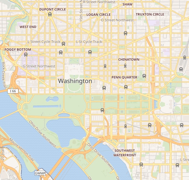
Location_map_Washington,_D.C._central.png (627 × 599 dagiti piksel, kadakkel ti papeles: 218 KB, kita ti MIME: image/png)
| Daytoy ket papeles a nagtaud manipud idiay Wikimedia Commons. Ti pakaammo manipud iti bukodna a deskripsion a panid idiay ket naiparang dita baba. Ti Commons ket repositorio dagiti nawaya a nalisensiaan a midia. Mabalinmo ti tumulong. |

|
This city map image could be re-created using vector graphics as an SVG file. This has several advantages; see Commons:Media for cleanup for more information. If an SVG form of this image is available, please upload it and afterwards replace this template with
{{vector version available|new image name}}.
It is recommended to name the SVG file “Location map Washington, D.C. central.svg”—then the template Vector version available (or Vva) does not need the new image name parameter. |
| Description |
This map of Washington D.C. was created from OpenStreetMap project data, collected by the community. This map may be incomplete, and may contain errors. Don't rely solely on it for navigation. |
|||||||||
| Petsa | (see file history) | |||||||||
| Taudan | openstreetmap.org | |||||||||
| Creator |
OpenStreetMap contributors |
|||||||||
| Pammalubos (Ti panagusar manen iti daytoy a papeles) |
OpenStreetMap data and maps are licensed under the Creative Commons Attribution-ShareAlike 2.0 license (CC-BY-SA 2.0). Daytoy a papeles ket nalisensiaan babaen ti Creative Commons Attribution-Share Alike 2.0 Generic a lisensia.
|
|||||||||
| Geotemporal data | ||||||||||
| Bounding box |
|
|||||||||
| Georeferencing | If inappropriate please set warp_status = skip to hide. | |||||||||
Pakasaritaan ti papeles
Pinduten iti petsa/oras tapno makita ti papeles a kas naiparang iti dayta a panawen.
| Petsa/Oras | Bassit a ladawan | Dagiti rukod | Agar-aramat | Komentario | |
|---|---|---|---|---|---|
| agdama | 20:41, 8 Septiembre 2018 | | 627 × 599 (218 KB) | LinkTiger | Get same image from Wikimedia's map server: https://maps.wikimedia.org/img/osm-intl,14,38.893,-77.03075,627x599.png It's still bad, but maybe not quite as bad? |
| 13:23, 21 Abril 2016 |  | 796 × 761 (713 KB) | LinkTiger | Use latest OpenStreetMap style, which includes GSoC road visibility updates | |
| 08:33, 6 Nobiembre 2013 |  | 796 × 761 (662 KB) | Ebywan | Update to current OpenStreetMap data | |
| 18:34, 26 Mayo 2010 |  | 796 × 761 (579 KB) | Dr. Blofeld~commonswiki | {{Information |Description={{en|1=j}} |Source=j |Author=j |Date=j |Permission= |other_versions= }} |
Panagusar iti papeles
Ti sumaganad a 3 a pampanid ket agus-usar iti daytoy a papeles:
Global a panagusar ti papeles
Dagiti sumaganad a wiki ket agus-usar iti daytoy a papeles:
- Panagusar idiay ar.wikipedia.org
- Panagusar idiay bh.wikipedia.org
- Panagusar idiay bn.wikipedia.org
- Panagusar idiay ceb.wikipedia.org
- Panagusar idiay ce.wikipedia.org
- Panagusar idiay en.wikipedia.org
- United States Capitol
- Vietnam Veterans Memorial
- White House
- National Academies of Sciences, Engineering, and Medicine
- Lincoln Memorial
- Washington Monument
- National Air and Space Museum
- Hart Senate Office Building
- Jefferson Memorial
- John F. Kennedy Center for the Performing Arts
- Franklin Delano Roosevelt Memorial
- Ford's Theatre
- Korean War Veterans Memorial
- World War II Memorial
- United States Holocaust Memorial Museum
- Watergate complex
- Ronald Reagan Building and International Trade Center
- George Mason Memorial
- Russell Senate Office Building
- Cannon House Office Building
- Corcoran Gallery of Art
- Arts and Industries Building
- Willard InterContinental Washington
- International Spy Museum
- Mayflower Hotel
- National Postal Museum
- National Museum of Women in the Arts
- J. Edgar Hoover Building
- Cathedral of St. Matthew the Apostle (Washington, D.C.)
- President's Park
- Dirksen Senate Office Building
- District of Columbia War Memorial
- Washington Circle
- S. Dillon Ripley Center
- Eisenhower Executive Office Building
- National Museum of African Art
- St. John's Episcopal Church, Lafayette Square
- United States Supreme Court Building
Kitaen ti adu pay a global a panagusar iti daytoy a papeles.