Papeles:Mali.A2001291.1045.250m.jpg

Kadakkel daytoy a panagipadas: 800 × 600 dagiti piksel. Sabali kadagiti resolusion: 320 × 240 dagiti piksel | 640 × 480 dagiti piksel | 1,024 × 768 dagiti piksel | 1,280 × 960 dagiti piksel | 2,560 × 1,920 dagiti piksel | 4,000 × 3,000 dagiti piksel.
Kasisigud a papeles (4,000 × 3,000 dagiti piksel, kadakkel ti papeles: 1.75 MB, kita ti MIME: image/jpeg)
| Daytoy ket papeles a nagtaud manipud idiay Wikimedia Commons. Ti pakaammo manipud iti bukodna a deskripsion a panid idiay ket naiparang dita baba. Ti Commons ket repositorio dagiti nawaya a nalisensiaan a midia. Mabalinmo ti tumulong. |
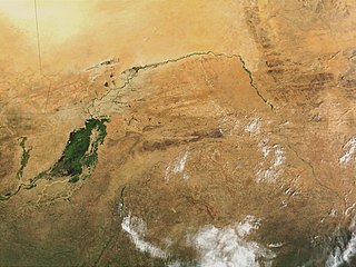
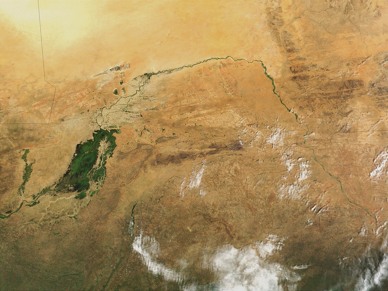
| Deskripsion | Niger River in Mali, 2001. Just south of the Sahara Desert in Africa, the Niger River creates a lush area of wetlands and lakes in an otherwise arid environment. In this true-color MODIS image from October 18, 2001, the Niger enters at left as a thin strip of green and flows northeast through Mali. The river then turns south and heads into the country of Niger. (Note, this is at the end of the rainy season, showing the Niger Inland Delta in dark green). | |||||
| Petsa |
Visualization Date 2001-10-18 |
|||||
| Taudan | http://veimages.gsfc.nasa.gov/2243/Mali.A2001291.1045.250m.jpg | |||||
| Mannurat | Jacques Descloitres, MODIS Land Rapid Response Team, NASA/GSFC | |||||
| Pammalubos (Ti panagusar manen iti daytoy a papeles) |
PD, US Gov
|

Pakasaritaan ti papeles
Pinduten iti petsa/oras tapno makita ti papeles a kas naiparang iti dayta a panawen.
| Petsa/Oras | Bassit a ladawan | Dagiti rukod | Agar-aramat | Komentario | |
|---|---|---|---|---|---|
| agdama | 22:43, 8 Marso 2008 | | 4,000 × 3,000 (1.75 MB) | T L Miles | {{Information |Description=Niger River in Mali, 2001. Just south of the Sahara Desert in Africa, the Niger River creates a lush area of wetlands and lakes in an otherwise arid environment. In this true-color MODIS image from October 18, 2001, the Niger en |
Panagusar iti papeles
Ti sumaganad a panid ket agus-usar iti daytoy a papeles:
Global a panagusar ti papeles
Dagiti sumaganad a wiki ket agus-usar iti daytoy a papeles:
- Panagusar idiay af.wikipedia.org
- Panagusar idiay as.wikipedia.org
- Panagusar idiay bg.wikipedia.org
- Panagusar idiay ca.wikipedia.org
- Panagusar idiay cy.wikipedia.org
- Panagusar idiay en.wikipedia.org
- Panagusar idiay eo.wikipedia.org
- Panagusar idiay fr.wikipedia.org
- Panagusar idiay ja.wikipedia.org
- Panagusar idiay la.wikipedia.org
- Panagusar idiay no.wikipedia.org
- Panagusar idiay oc.wikipedia.org
- Panagusar idiay pt.wikipedia.org
- Panagusar idiay sr.wikipedia.org
- Panagusar idiay sv.wikipedia.org
- Panagusar idiay sw.wikipedia.org
- Panagusar idiay ta.wikipedia.org
- Panagusar idiay uk.wikipedia.org
- Panagusar idiay zh.wikipedia.org